Environmental & Agricultural Monitoring
Technology is transforming the way we manage land, resources, and the environment. By combining drones for aerial insights with robotics for ground validation, industries gain faster, more accurate, and safer data collection. This modern approach improves efficiency, reduces risks, and supports more sustainable practices across fields like forestry, agriculture, security, and environmental monitoring.

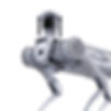
Agriculture Crop Spraying
Precision Application
Drones and robotic sprayers apply chemicals only where needed, reducing waste and protecting surrounding ecosystems.
Cost and Labor Efficiency
Automated spraying reduces the need for manual labor, cuts input costs, and improves coverage in large or difficult fields.
Environmental Benefits
Targeted spraying prevents runoff and minimizes chemical exposure, promoting healthier soils and waterways.

Precision Agriculture Monitoring
Aerial Imaging for Crops
Multispectral drone cameras capture plant stress, pest outbreaks, and irrigation needs across large fields.
Soil and Root Analysis
Ground robotics measure soil moisture, nutrient levels, and root conditions to validate aerial findings.
Yield Prediction
By merging aerial and ground data, farmers forecast yields more accurately and plan harvests with confidence.

Forestry Management
Canopy Health Monitoring
Drones equipped with multispectral and thermal sensors scan tree canopies to detect disease, pest infestations, and drought stress. This early detection helps forest managers intervene before widespread damage occurs.
Fire Risk Assessment
Thermal imaging from aerial drones identifies hotspots and dry zones likely to ignite. Combined with robotics gathering ground fuel data, managers can predict and reduce fire hazards more effectively.
Reforestation Tracking
Robots monitor soil quality and seedling growth, while drones capture aerial progress images. Together, they provide accurate reforestation updates, supporting sustainable forest regeneration.

Environmental Monitoring
Large-Scale Data Collection
Drones survey forests, water bodies, and terrain to monitor environmental changes over time.
Ground-Level Sampling
Robotics gather soil, water, and microclimate samples that confirm aerial observations.
Ecosystem and Climate Insights
Together, they deliver a comprehensive picture of ecosystem health and climate change impacts.

Wildlife Conservation
Population Tracking
Drones monitor species numbers and migrations without disturbing habitats.
Habitat Monitoring
Robotics deploy sensors and cameras in remote environments for continuous observation.
Anti-Poaching and Protection
Technology helps detect illegal activity and safeguard endangered species from human threats.

Coastal & Marine Monitoring
Shoreline and Erosion Tracking
Drones document coastal shifts, erosion, and storm damage to protect vulnerable communities.
Underwater Robotics
Submersibles collect data on reefs, marine life, and pollution below the surface.
Conservation and Policy Support
These insights guide coastal protection policies and marine conservation initiatives.

Port & Harbor Security
Aerial Surveillance
Drones patrol above ports, scanning ships and docks with thermal and optical cameras for security threats.
Robotic Vessel Monitoring
Autonomous robots monitor harbor activity, detect unauthorized entry, and respond faster than manned patrols.
Integrated Safety Systems
Combining drones and robotics creates layered defense, improving situational awareness for port authorities.

Topographic Mapping
High-Resolution Terrain Imaging
Drone-based photogrammetry produces detailed aerial images that form the basis of digital terrain models, revealing natural and man-made features.
Ground Validation with Robotics
Robotic survey tools confirm elevations and validate aerial data, ensuring accuracy in engineering and scientific applications.
Applications Across Industries
From construction planning to environmental research, topographic mapping enables precise decision-making and reduces costly surveying delays.

Air Quality Monitoring
Pollutant Detection by Drones
Drones track air pollutants across vertical layers, mapping hotspots invisible to ground monitors.
Ground-Level Robotics
Robotic systems measure gases and particulates at human exposure levels, complementing aerial data.
Public Health Applications
Combined insights help city planners, industries, and governments improve air quality policies.

Greenhouse Gas Detection
Drone-Based Sensors
Airborne sensors detect methane and other gases across pipelines, facilities, and industrial zones.
Ground Robotics Validation
Robots pinpoint exact leak sources, confirming aerial detections for rapid repair.
Regulatory and Environmental Benefits
Faster detection ensures compliance, reduces emissions, and lowers financial losses.

Event Coverage
Aerial Perspectives
Drones provide sweeping overhead shots of concerts, sports, and festivals, adding dramatic visuals.
Ground Robotics Filming
Robotic cameras capture stable, dynamic footage from within crowds for immersive storytelling.
Broadcasting Impact
Combined coverage enhances live streams, social media content, and marketing campaigns.


.jpg)
_jfif.jpg)